

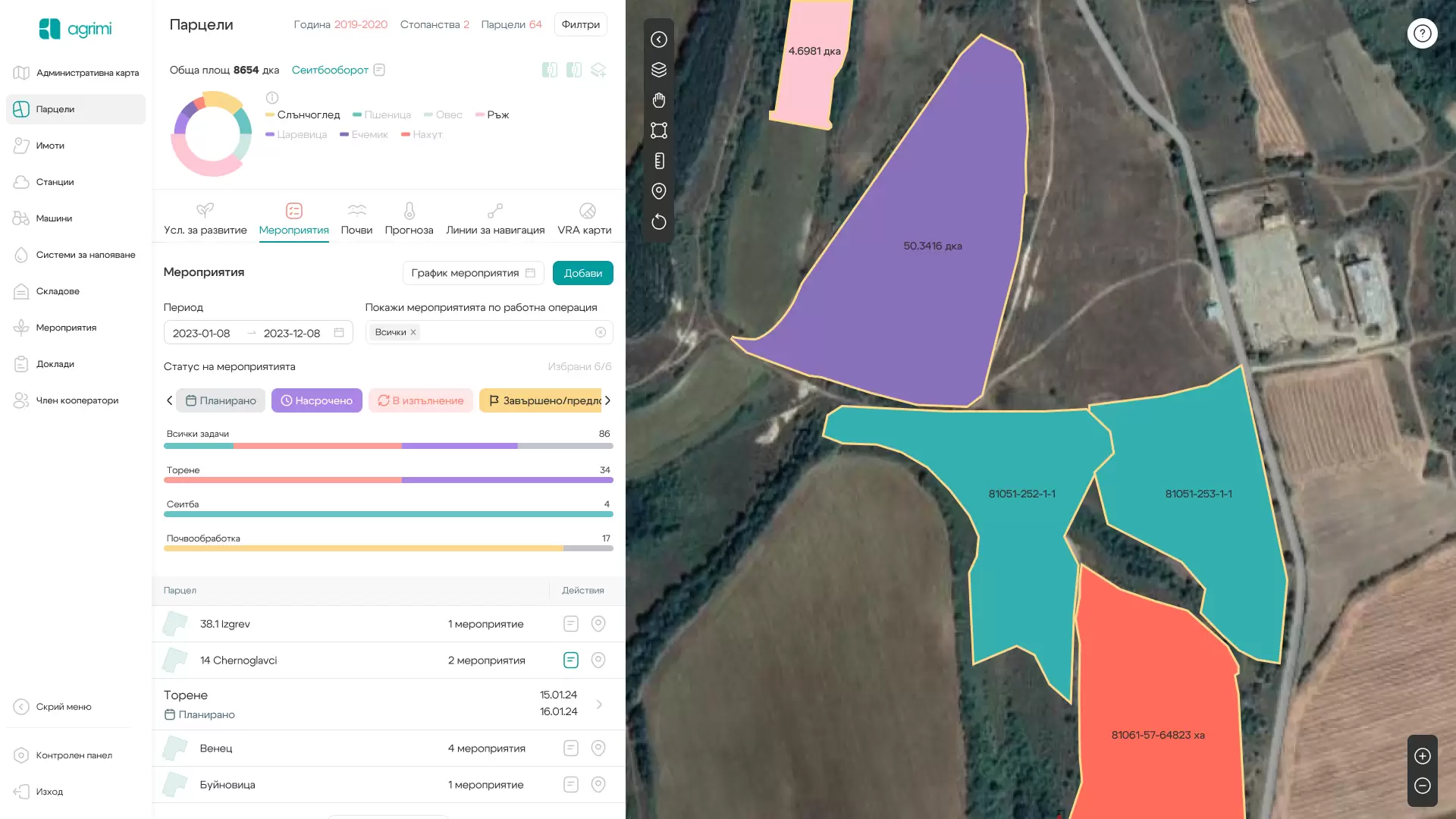
Module Plots
- Periodic satellite capture and visualization of photographs and vegetation index — NDVI and water content index — NDWI
- Digital agrochemical maps of nutrient distribution as a result of soil laboratory analyses
- Data from the soil samples/route of the equipment/on the farm and access to the archive of all the samples taken.
- Visualization and management of crop rotation on the farm
- Planning and reporting of agrotechnical measures, application of cost norms, products and calculation of cost of production - by crops, farms, plots
- Visualization of fertilization recommendations and variable fertilization maps (VRA)
- Create AB lines and navigation lines along the boundary of parcels
- Meteorological information for each field — expected rainfall, temperatures and conditions for the implementation of the events
Advantages
Accurate planning of agrotechnical activities
Accurate sampling database
Precise tracking of crop development throughout the year
Ability to plan precision machining
You can access the information through the mobile application
Contact us
Follow us