


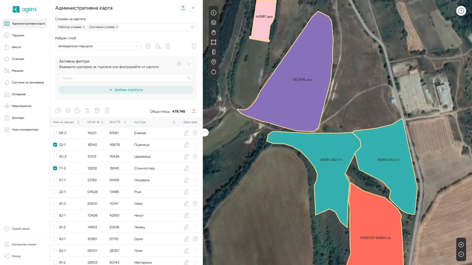
Functionalities:
- Selection on the basis of a map of several types of satellite images, on which KBC boundaries and other layers used when applying for subsidies can be visualized
- Visualize the following layers for the territory of the whole country:
- Preliminary allowable layer for the whole of Bulgaria
- Final allowable layer for the whole of Bulgaria
- Layer with permanently fertilized areas
- Layer with disadvantaged areas for the whole territory of Bulgaria
- Layer with NATURA 2000 zones with orders in force
- Specialized layers of Agroecology related to land with HPS
- A rich set of tools for delineating and editing the boundaries of parcels
- Extensive export range for various navigations
Advantages
Independent loading of data for current KBs and data for users and owners provided by the CSO
Preparation of areas after agreements
Successful application for direct payments
Find a property in the field using the Trimble mobile app and navigation
Preparation of thematic map by owners and users of the properties
Existence of history from previous years
Information about the cultivable part of all properties
Contact us
Follow us