Efficient data management on the farm: Mobile applications
In the second part of the series Efficient data management on the farmwe will tell you how only with the help of your mobile phone, you can manage your entire farm so that it is even more profitable and efficient.
Thanks to digitization, today more than ever we use our mobile phone for calls, information searches, calculations, new acquaintances, listening to music and what else! Digitalisation has also inevitably affected the Agriculture sector, with farms today being much more modern and innovative.
Information is the key to making a successful decision. In agriculture, information from the field is that indispensable part that enables you to make an accurate, correct and timely decision, which will subsequently reflect on the more efficient management of the overall processes on the farm.
In today's article we will tell you more about NIK mobile applications and how they can add value to your farm.
Track and analyze farm machine data with the FarmTrack mobile app
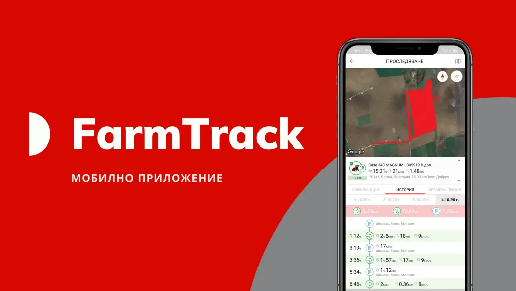
Farming is not an easy job. Especially during an active campaign, when it is extremely important to monitor any activity on the farm, while at the same time monitoring the operation of machinery and the condition of the fleet. This is where the machine and fuel monitoring service comes to the rescue — FarmTrack.
Thanks to FarmTrack, you can track remotely any activityon your farm, while at the same time you have an overview of the state of the fleet and the operation of the machines and mechanizers.
Through mobile appOn FarmTrack you can monitor in real time the movement, status and location of your machines, while tracking information on routes traveled, refueling, fuel and equipment parking.
Another of the functionalities of the program for GPS tracking of machines and fuel is the ability to video monitor what is happening inside or outside the cabin of the agricultural machine. And thanks to the FarmTrack mobile app, you can access your machine data and reports anytime, from any device.
In addition, you can easily and quickly get a report on:
— Routes
— Km traveled — start and end mileage
— Maximum speed
— Fuel consumed
— Fuel missing/theft
— Loaded fuel
— Motor hours
— Service/upcoming service
— On-site work
— Parking lots
Information about any property at a click away with the TechnoFarm mobile app
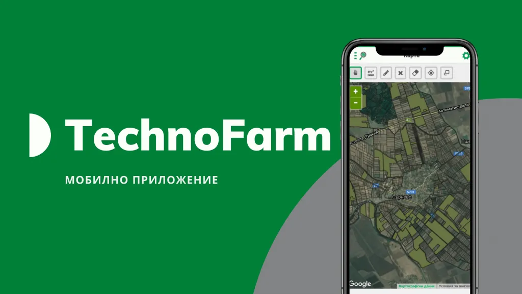
The agricultural software TechnoFarmhas established itself as a modern and full-featured software for farm management and information related to the cultivated land in them. This is due to the fact that the software facilitates the activities of delineating property and applying for direct payments, administering agricultural land and contracts, paying rents, submitting survey cards and declarations, planning events on the plots, accounting for the processing carried out, and much more.
In combination with Trimble navigationfrom NIK, TechnoFarm helps to monitor the activities carried out on the farm at the end of each working day, as well as to plan the activities on plots, machines and mechanisms day by day.
Through mobile appAt TechnoFarm, you can easily discover your properties on the ground. The application also allows access to additional information about each property such as area, category, locality, etc.
With TechnoFarm, you can quickly delineate the areas of your field, as well as discover the boundaries of the properties from the KBC or blocks of agreement. Very often TechnoFarm also comes into use of mechanizers, helping them to orient themselves in a given terrain using satellite photography.
Another advantage of the farming software application TechnoFarme that it can be used on more than one mobile device at the same time. And synchronization with the desktop version occurs automatically.
System crop monitoring directly from the phone with GeoScan
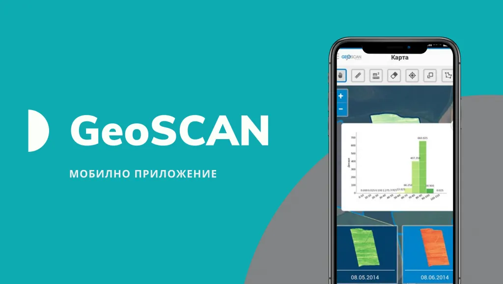
The third application, with which you can optimize work processes on the farm and in the field, is to the system GeoScan.
The platform for crop monitoringis of the most advanced technologies for the analysis and processing of satellite images and allows the capture of large territories in a short time.
Thanks to the images obtained, you have the possibility to follow in real time the progress of the crops and the quality of the treatments - without having to physically crawl the fields. But also to identify problem areas and take timely measures to improve yield.
Through mobile appGeoScan you have the opportunity to visit on the spot the problem area established on the map. Thanks to a photo from the camera of the device and additional notes, you will have a detailed database of crop development and the necessary agrotechnical measures.
With the mobile app you can also:
- Recognize problem areas experiencing stress;
- To recognize the places in need of agrotechnical measures;
- Recognize areas with different potential productivity.
The GeoScan mobile app supports field survey activities, also helping you with farm planning and reporting.
Find out more about NIK's mobile apps — FarmTrack, TechnoFarmand GeoScanor are contact our team.
Expect the next steps for more efficient data management on the farm with solutions from NK
Other articles
.webp)